GeoPro Talks: Water Quality Modelling Demystified: From Conceptual Model to Decision Tool
GeoPro Talks: Compound-Specific Isotope Analysis (CSIA) to Assess Remediation Performance at Petroleum Hydrocarbon-Contaminated Sites
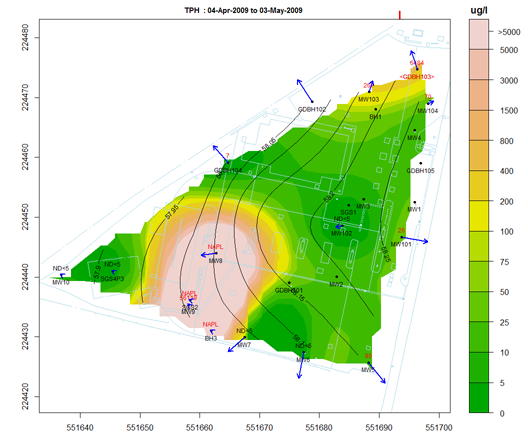
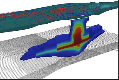
GeoPro Talks: BETWEEN A ROCK AND A HARD PLACE – A case study of how bedrock was investigated at a petroleum hydrocarbon contaminated site

GeoPro Talks: GWSDAT= GroundWater Spatiotemporal Data Analysis Tool.
GWSDAT (www.gwsdat.net) is an open source, user-friendly, application developed in the collaboration with the University of Glasgow for the visualization and interpretation of groundwater monitoring data. In this talk, Wayne will tell the story behind GWSDAT since its first release over 10 years ago and will explain the critical factors for successful uptake in the […]
Rerun GeoPro Talks – Don’t Forget to Look Up…or Down! Some things to think about when assessing groundwater flow
GeoPro Talks is pleased to present Stephen Munzar with Core 6 Environmental on a fundamental hydrogeology topic: “ Don’t Look Up…or Down – Some things to think about when assessing groundwater flow ”. You don’t want to miss this one! It’s a re-run from a few years ago but remains highly relevant today. And Stephen will join us live […]
GeoPro Talks: A Tour of Groundwater Challenges in the High Atlas Mountains, Morocco
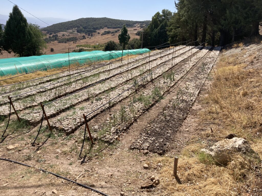
This picture-rich presentation will provide insight into the challenges that rural farmers have faced as a result of a persistent drought that began in 2017. Namely, groundwater wells have dried, farms have failed, and new wells have not yielded sufficient water. A hydrogeologic assessment at 5 farms in the summer of 2023 reveal that there […]
Groundwater Quality vs Groundwater Quantity: An Emerging Industry
GPro Talks – Background Groundwater and Technical Bulletin 03
GeoPro Talks: Don’t Forget to Look Up…or Down! Some things to think about when assessing groundwater flow
GeoPro Talks: 2023 Virtual Field School – Field Sampling Methods for Contaminated Lands Investigation
On May 24, 2023, 10-10:30 Zahra Pirani and Dr. Ian Hers will provide a preview of the 2023 GeoEnviroPro Field School, to be held June 5-12. “Field School” is designed to address key elements of field methods and protocols for contaminated sites investigations following latest guidance and best practices. In this course, we bring that […]